
What is AquaVector?
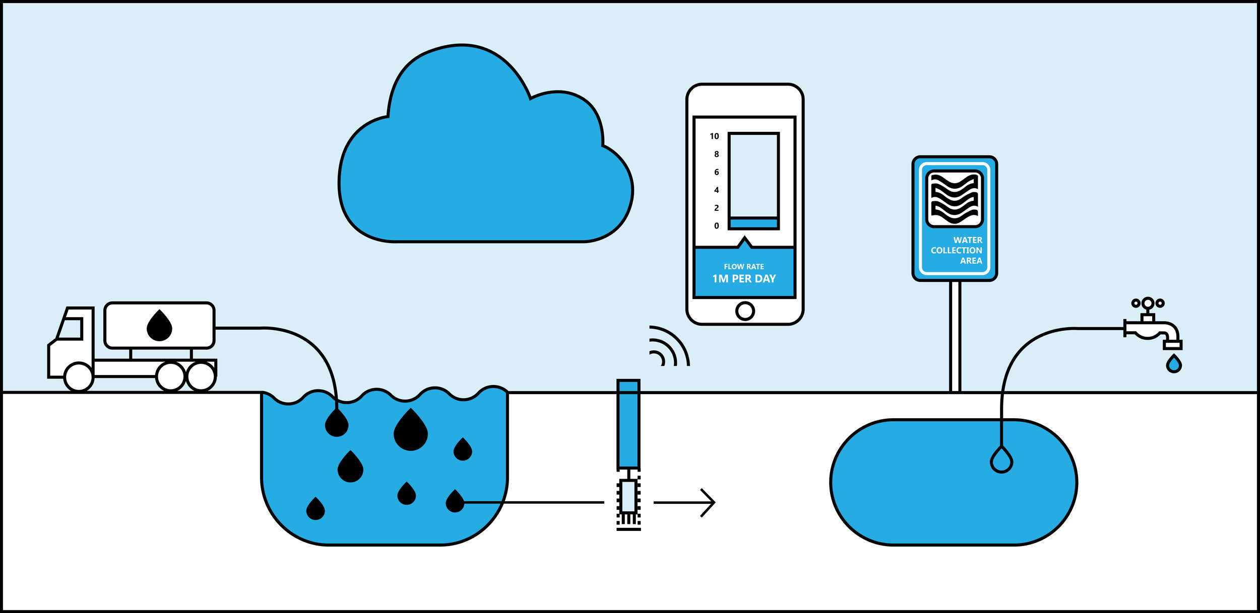
AquaVector is a groundwater sensor for measuring flow rate and flow direction. The detailed measurements by AquaVector offer great value to supplement or validate groundwater models, and for control of underground processes, such as seasonal thermal energy storage systems and groundwater remediation. AquaVector is fast and reliable and delivers direct measurements of groundwater flow, instead of a derivation from contextual data as with other methods. The current AquaVector system offers point-scale measurements of groundwater flow direction and speed at six locations in a research area, within a day.
AquaVector uses a heat pulse in combination with temperature sensors to measure the groundwater flow. With this technique point-scale measurements in wells up to 50 meters deep can be performed. Using these actual and location specific data, decisions can be made based on accurate measurements, in addition to estimated regional data or model results.
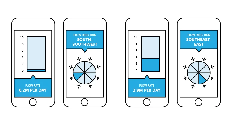
“ It is super handy that the results are accessible with your own mobile phone.”
Strengths
Quick insight in the direction and rate of groundwater flow;
Local and actual data instead of regional estimates based on historical and indirect data;
Measurements over long timespan, resulting in insight in the dynamics of groundwater flow;
Detailed, location-specific information: crucial in urgent situations, such as local contamination.
Applications
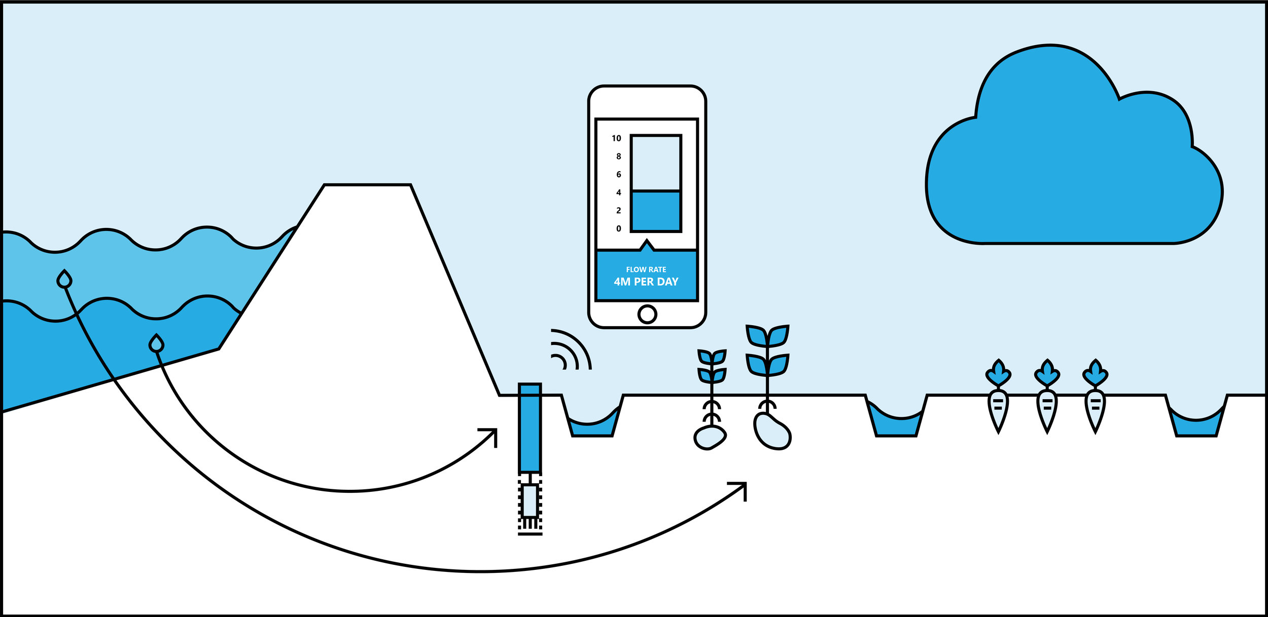
Insight in the interaction between surface water and groundwater, monitoring the movements of contaminants and the evaluation of water flow towards groundwater abstractions.
Dynamic monitoring of seepage and the interaction between fresh and saline groundwater in coastal areas.
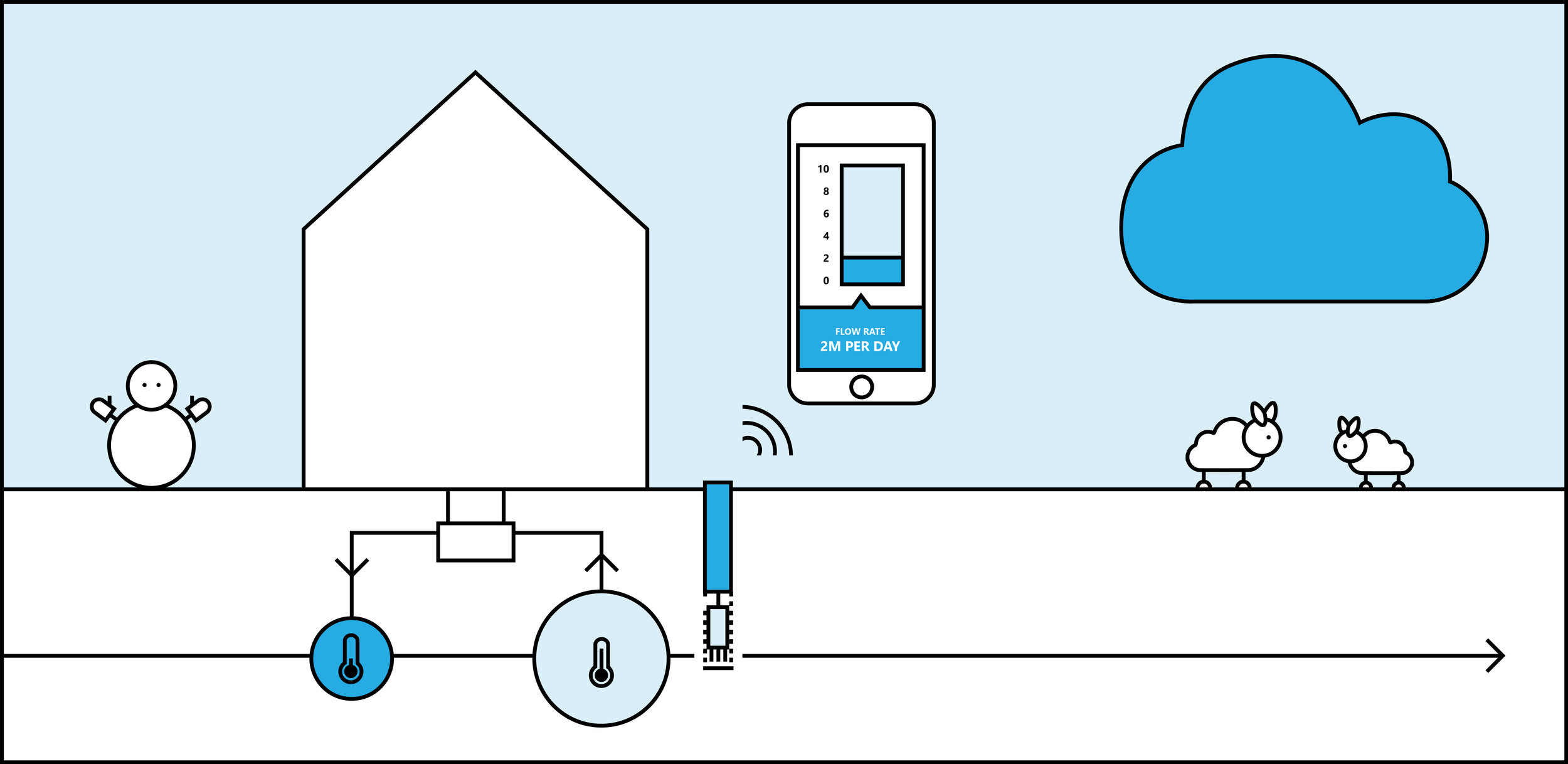
Monitoring and evaluating effects of seasonal thermal energy storage systems, seasonal underground storage of fresh water (‘aquifer storage and recovery’) and other situations in which pumping and infiltration of groundwater occurs.
The Value of AquaVector
AquaVector delivers insight in groundwater dynamics. Reliable and precise. The application of AquaVector is useful in projects where local groundwater data are needed, for example in case of groundwater withdrawal, groundwater contamination, and risk of salinization. Particularly in situation where traditional isohypse maps fail. With AquaVector ground models are supplemented by local measurements of flow direction and flow rate.
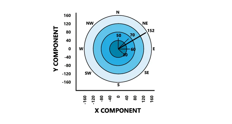
Result of one measurement in a well: orientation (east northeast, 59°) and signal strength (a measure of flow rate) of the sensor measurement.
“Repeated measurements with different configurations provide increased accuracy.”
Testing the method
The measurement principle of AquaVector has been tested in control experiments in the Kraijenhoff van de Leur Laboratorium at Wageningen Universiteit and field situations. The purpose of the tests was to get insight in the reliability of the technique and to assess the addition of the technique to the hydrologist’s instrumentation for measuring groundwater flow.
The tests showed that measurement repeatability was good in PVC well screens. By performing repeated measurements, potential bias at low flow rates can be suppressed. The direction can be resolved within bounds from -7° to 35°. Next to this, the magnitude of the signal linearly increases with flow rate, yielding a clear relation between instrument response and flow rate.
Current state
Currently, an autonomously operating AquaVector system is being developed. The resulting system will be able to perform high-frequency measurements, and can be used in monitoring networks. The first prototype was ready in the last part of 2017. At this moment pilot projects will be carried out.